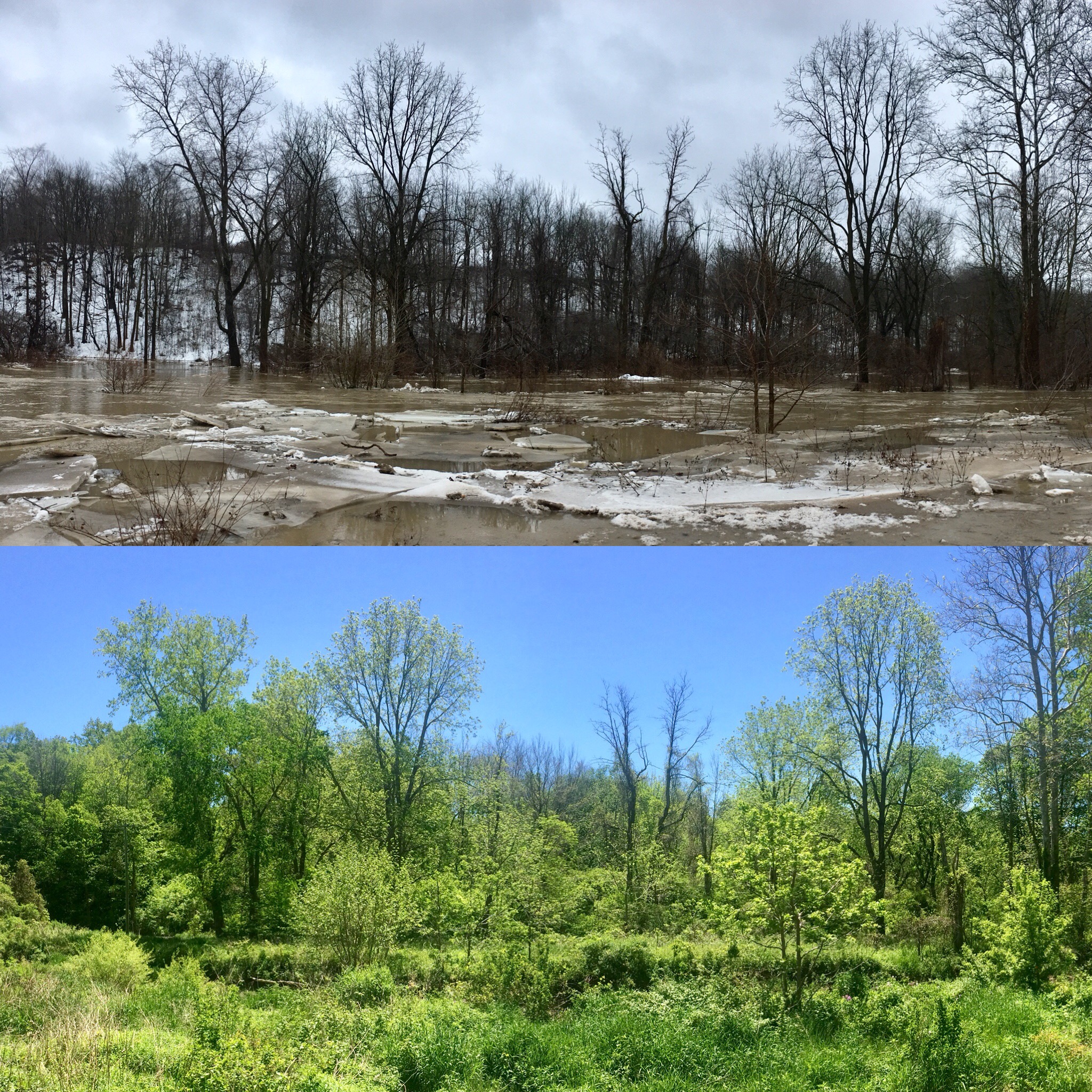
This photo depicts my research site in Parkhill, Ontario in two wildly different states. The upper half of the photo was taken in January 2018, where a large snow melt event produced the greatest stream flows in recorded history at the site. The lower photo was taken during the heart of summer 2018 and represents the typical state of the stream and its surrounding environment. Water quality sampling of this stream is completed on a monthly basis for the purpose of assessing nutrient (phosphorus and nitrogen) transport pathways and groundwater surface water interactions in an agriculture intensive watershed.
- About the Office of Research
- Welcome Message
- Meet the Vice-President (Research)
- Strategic Research Plan
- Mission Statement
- Services and Divisions
- Committees
- Discover our Research
- Research Chairs
- Facts and Figures
- Centres, Institutes, and Groups
- International Research
- Find a Researcher
- For Researchers
- Safeguarding Research
- Commercialization Policy and Framework
- Equity, Diversity, and Inclusion in Research
- Research Alerts
- Funding
- Ethics and Regulatory Compliance
- Research Integrity and Conflict of Interest
- Patenting, Licensing, and Commercialization
- Honours and Awards
- Ontario Agri-Food Innovation Alliance
- Other Considerations and Resources
- Forms, Policies, Guidelines, and Procedures
- Interactive Support Sessions for Researchers
- Researcher Training and Development
- Research Administration Information Management System (RAIMS)